By Vian Andrews, Editor, VisitsItaly.com, December 2005
MapQuest:
Carsulae (San Gemini)
Wikipedia:
Carsulae
References:
Umbria Regional
Government;
Comune di Terni;
Bill Thayer's "Carsulae"
How to get there by Car: From Perugia go south on the E45 about 70 km; From Rome, North on the A1 to Orte, then west to Terni, then north on the E45 about 104 km; From Terni about 28 km - go west on the SS204, then north on the E45.
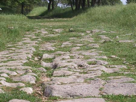
Carsulae, now one of the most important archaeological ruins in Italy, probably had its origins as a rest stop and watering place for travelers, traders and soldiers, but most historians fix the town's official founding to about 300 BC. Carsulae's growth into a major town only took place, however, with the building of the ancient Roman road, the via Flaminia, in 220-219-BC.
When the via Flaminia was built, its western branch proceeded north from Terni, sparking the development not only of Carsulae, but also of Acquasparta and Bevagna. This branch of the road courses through a gently rolling upland plain at the foot of the Martani mountain range, an area that had been heavily populated since the middle of the Bronze Age. The eastern branch proceeded from Terni, north to Spoleto, then past Trevi and finally to Foligno, where it merged with the western branch.
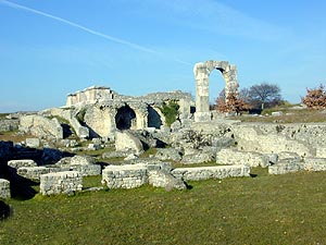
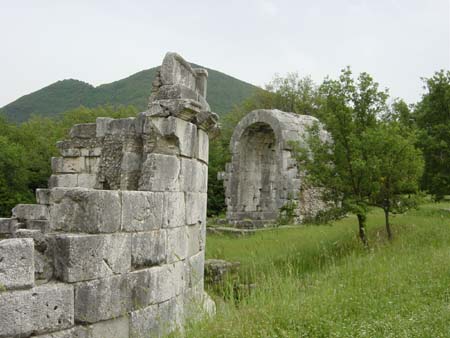
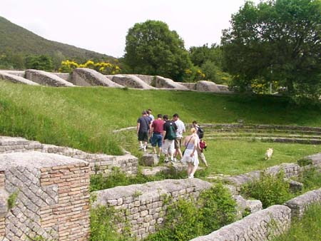
In due course, during the age of Emperor Augustus, Carsulae became a Roman municipium. It was during his reign that a number of major works, including the amphitheatre, most of the forum, and a marble-clad arch (now called the Arch of San Damiano) at the north entrance were built. During its "golden age" Carsulae, supported by agricultural activity in the surrounding area, was prosperous and wealthy. It bucolic setting, its large complex of mineralized thermal baths, theatres, temples and other public amenities, attracted wealthy and even middle class "tourists" from Rome.
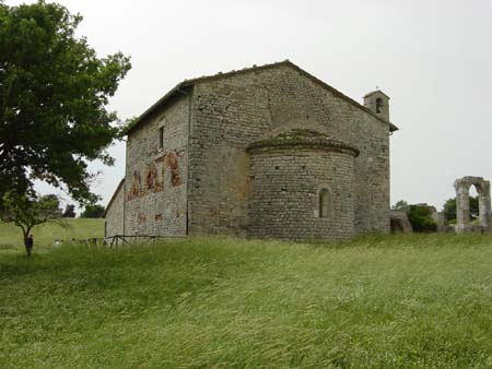
However, while all the other mentioned towns and cities on the two branches of the old Roman road continue to exist, nothing but ruins remains of Carsulae, which was abandoned, and once abandoned, never resettled. The only subsequent building that took place occured in paleo-Christian times, say about the 4th or 5th century, at the southerly entrance to Carsulae, where the church of San Damiano, still standing today, was built for a small community of nuns on the foundations of an earlier Roman building.
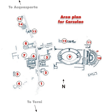
For centuries after it was deserted, Carsulae was used as a quarry for building materials that were used elsewhere, such as in Spoleto, but otherwise, it was left alone. Consequently, archaeologists have been able to map the city with considerable detail. (See the diagram below).
No one knows the precise reasons why Carsulae was abandoned, but the two reasons that seem most plausible are first, that it was almost destroyed and the site made inhospitable by earthquake, and second that it lost its importance, and as a result became became increasingly impoverished, because most of the important north-south traffic used the faster east branch of the via Flaminia.
Haphazard excavations took place in the 16th century under the direction of Duke Frederico Cesi, whose palace is in Acquasparta, and in the 17th century under the direction of Pope Pio VI, but not until 1951 were the ruins subjected to methodical archeological exploration and documentation. Significant additional work was also done in 1972, but little or no work has been done since.
|
||||||||||||||||||||||||||||||||||
This article, including the diagram and the list of monuments, was added to Wikipedia on December 25th, 2005 by Vian Andrews, Editor of VisitsItaly.com.